
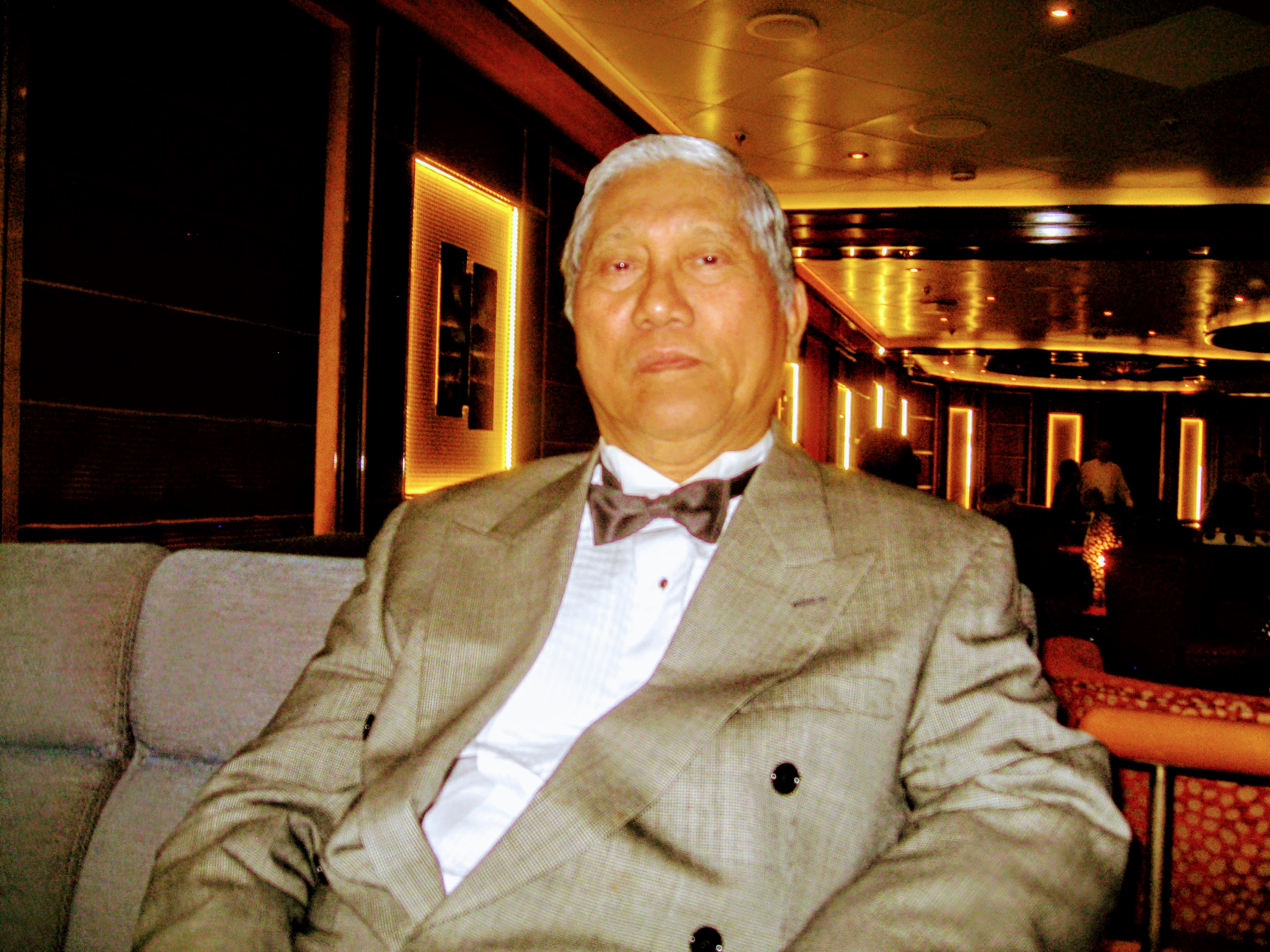
MEMORIES OF MY FATHER

MY FATHER CAPTAIN AMADO CATAMBAY...., GSC, PN, RIP
I like to pay tribute to my father as he lay in state before us. In his early life, when he was a young lad, his escapades, his thirst for education and eventualy his service to his country. In those days, before the great war, a secondary education was enough and the average attainment of that generation. College education for the poor is non existent. This is going beyond the means of the family. My grandparents were poor, and with four siblings more to feed, they were destined to a life as peasants. My father's perception of the future was dire, there was no future if he stayed in Tanay. He eventualy sought out, beyond this environment, with an eye just looking in at all his landed cousins. Traditions were, only the males of the family inherit the ricefields and lands. My grandmother did not.
He did his college education through servitude as a house boy of a well known professor, his uncle Alejandro at the University of the Philippines at Los Banos in Laguna. One can say that he was blessed in the safekeeping of relatives. If you consider the distance between Tanay with his parents and Los Banos as a matter of 30 miles, no brief vacation or visit to his parents was allowed until he graduated 4 years after in 1940. Such was the privations and spartan life that build the character of my father and maybe why he was suited as a military officer.
His obssesive work habits were formed at this early age. I know beyond everything else, that he was very industrious and this was a source of conflict to his subordinates and between us in later years. Early in his career as a naval officer, seldom we see him for seven years as he was assigned in Mindanao fighting the banditry movements of the muslims.
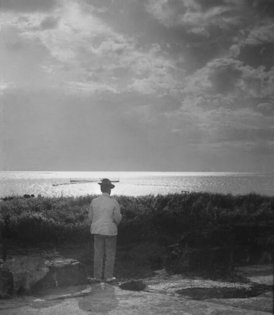
He will go on to higher positions, to take command of his own ship, then a number of ships as a task force commander, then Chief of Staff of the Philippine Coast Guard, a professor in academia at the National Defense College of the Philippines, a base commander at the Manila Naval Station and Cavite Naval Base at Sangley Pt. But what I remember most was him on the bridge of RPS 1133, and I a pre school kid, looking at a young Lt. taking his ship out to the open seas, out of Manila Bay.
And now the end is here, I still see him as a young man full of vigor and strength. He was and will always be my mentor on how to survive the tough streets of life.
In tribute to his service to his country of birth, an allegory written in the second half of the 19th century that befits him.
O Captain! my Captain! rise up and hear the bells;
Rise up-for you the flag is flung-for you the bugle trills;
For you bouquets and ribbon'd wreaths-for you the shores a-crowding;
For you they call, the swaying mass, their eager faces turning;
Here Captain! dear father!
This arm beneath your head;
It is some dream that on the deck,
You've fallen cold and dead.
My Captain does not answer, his lips are pale and still;
My father does not feel my arm, he has no pulse nor will;
The ship is anchor'd safe and sound, its voyage closed and done;
From fearful trip, the victor ship, comes in with object won;
Exult, O shores, and ring, O bells!
But I, with mournful tread,
Walk the deck my Captain lies,
Fallen cold and dead.
Lives of great men all remind us
We can make our lives sublime,
And, departing, leave behind us
Footprints on the sands of time
 |
 I always pass by this golf course on Mckinley Road. What I remember most was the abundance of huge acacia trees and vegetation that made the place cool. Established in 1901, this is undoubtedly Manila's preeminent golf club. The 18-hole course is impeccably maintained, while the clubhouse features a coffee shop, a restaurant and a gym for the relaxation of members. I always pass by this golf course on Mckinley Road. What I remember most was the abundance of huge acacia trees and vegetation that made the place cool. Established in 1901, this is undoubtedly Manila's preeminent golf club. The 18-hole course is impeccably maintained, while the clubhouse features a coffee shop, a restaurant and a gym for the relaxation of members.We learn more of our true history in our social intercourse on rural justice more than the news/books from the Western Media in our classroom years. We were somewhat brainwashed to think that people who fight to uplift themselves from social oppression were all bad. To look at the true story of the HUK Insurrection in the Philippines, is to open both sides of society, the poor and the rich. |
|


 These is located next to our home base at the Navy Village about a mile away. Chapel Sculpture Facade of the 60-ft tall chapel of the American Cemetery in Fort Bonifacio, Taguig City. The sculpture represents, from bottom to top, the young American warrior symbolized by St George, fighting his enemy, the dragon, in the jungle. Above them are the ideals for which he fought: Liberty, Justice, Country. Columbia, with the child symbolizing the future, stands at the zenith. Information sourced from the Manila American Cemetery and Memorial pamphlet.High Noon at the Batttlefield
Right hemicycle of the Manila American Cemetery, viewed from the entrance of the left hemicycle. The gap between the gray pebbles is the path to the memorial's chapel. For more information, please see
 In Memoriam Opposites
Shot at the Manila American Cemetery. The brownish smooth hardness of the limestone tablets against the dark, disordered patterns of the tree's foliage. Order and disorder. Life. Gone, and the living.
 Wall of the Missing. Continuing with the B&W project. Shot at the Manila American Cemetery in Fort Bonifacio, Taguig City. As the sun gently sinks, the shadows slowly draws across the names of the missing valiant - exactly 36,286 American and Filipino servicemen are recorded in these limestone tablets. Manila American Cemetery and MemorialManila American Cemetery and Memorial is located in Fort Bonifacio, Taguig City in Metro Manila, Philippines. Manila American Cemetery and Memorial Nave Chapel of Our Lady of the Miraculous Medal, Philippine Women's University, Manila, Philippines Pasig River viewed from old Ayala Bridge  Puerta de Isabel Gate through the old Spanish Wall, Intramuros, Manila Puerta Postigo del Palacio Gate, Intramuros, Manila, Philippines  The awesome interior of old Binondo Church ( Basilica of San Lorenzo Ruiz ) .... the patroness of this historic Dominican Church is the Nuestra Senora Del Rosario .  In College, I worked in this building with an export import company. | 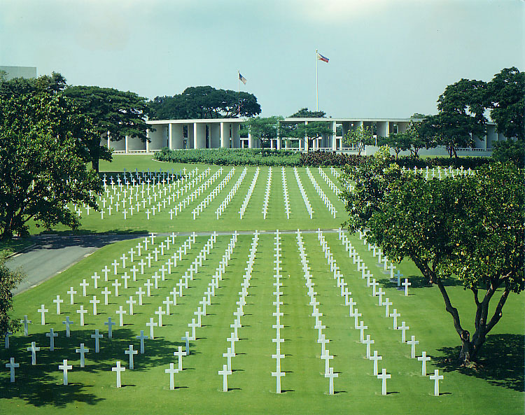  
 
 
|


 Bomod-ok Falls. Sagada, Mt. Province, Philippines Curvy Road over Mt. ProvinceSagada, Mt. Province Taal Volcano  Pasay City, Roxas Blvd. at Aristocrat (Barbecue Plaza) Plaza Miranda-Quiapo 1950's-1970's Metro Manila Quezon Blvd.- Quiapo1950's-1970's Metro Manila, Rizal Theater-Makati 1950's-1970's Metro Manila, Philippines Palm Sunday
Benediction every Monday afternoon. Our ritual at Espirito Santo Parochial School
|  Before I left for the US we visited Tagaytay for the last time. From the ridge, a magnificent view of Taal can be seen, and Taal lake as the picture above can be accessible by car from the main road. Taal volcano as seen from Picnic Grove on a cloudy day.
Taal Volcano is a complex volcano. Historical eruptions are concentrated on Volcano Island, an island near the middle of Lake Taal. The lake partially fills Taal Caldera, which was formed by powerful prehistoric eruptions between 140,000 to 5,380 BP. Viewed from Tagaytay Ridge, Taal Volcano and Lake presents one of the most picturesque and attractive views in the Philippines. It is located about 50 km ( 31 miles ) south of the capital of the country, the city of Manila.
|
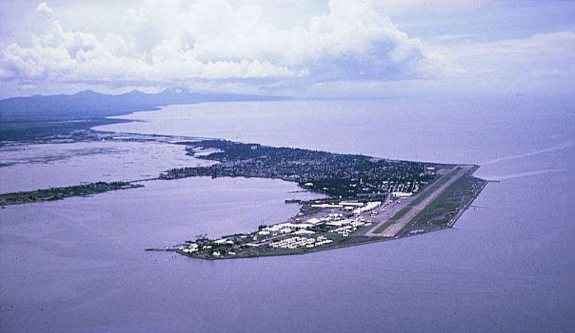
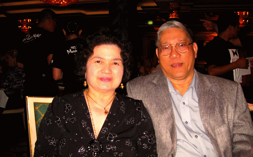
Sangley Point Air Base . My father became the CO of Sangley Point Cavite Naval Base in the 70’s.

I would be remiss if I do not mention my favorite swimming hole in Tanay, Daranak Falls. Remembering fondly, cherishing memories of early summer vacations spent at this place. This 14-meter high falls is truly a refreshing site. A short walk over the top of Daranak are smaller, cascading streams known as Batlag Falls. It is located at Bgy. Tandang Kutyo in the town of Tanay. The place has been transformed into a public park/resort operated by the government.
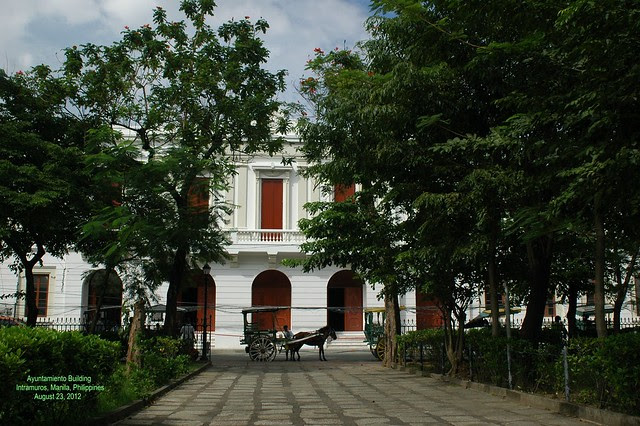
 Aurora Blvd.-Cubao1950's-1970's Metro Manila, Old Capitol Movie TheaterCapitol Theatre Art Deco in Escolta, Manila. Capitol used to be one of the finest movie houses in the Philippines until the 1960s. A smile shines thru. The Philippine Santa Cruzan celebration is held each month of May. It highlights a religious procession participated in by beautiful ladies, among them a "Reyna Elena." They depict the historic search of the Holy Cross by Queen Helena and her son Constantine the Great. Typical corner cafe and street vendor up front Manila hemp arriving in cart loads at a Manila warehouse Carabao cart hauling lumber the old energy efficient Filipino way, Manila Ayuntamiento Building, Intramuros, Manila |


Independent Philippines and the Third Republic (1946-1972). In April 1946, elections were held. Despite the fact that the Democratic Alliance won the election, they were not allowed to take their seats under the pretext that force had been used to manipulate the elections. The United States withdrew its sovereignty over the Philippines on July 4, 1946, as scheduled.
Manuel Roxas (Liberal Party), having been inaugurated as President as scheduled, on July 4, 1946 before the granting of independence, strengthened political and economic ties with the United States in the controversial Philippine-US Trade Act, In Mar., 1947, the Philippines and the United States signed a military assistance pact (since renewed) which allowed the US to participate equally in the exploitation of the country's natural resources—and rented sites for 23 military bases to the US for 99 years (a later agreement reduced the period to 25 years beginning 1967). These bases would later be used to launch operations in the areas of Korea, China, Vietnam, and Indonesia. During the Roxas administration, a general amnesty was granted for those who had worked together with the Japanese while at the same time the Huks were declared illegal. His administration ended prematurely when he died of heart attack April 15, 1948 while at the US Air Force Base in Pampanga. Vice President Elpidio Quirino (Liberal Party, henceforth referred to as LP) was sworn in as President after the death of Roxas in April 1948. He ran for election in November 1949 against Jose P. Laurel (Nacionalista Party, henceforth referred to as NP) and won his own four-year term. During this time, the CIA under the leadership of Lt. Col. Edward G. Lansdale was engaged in paramilitary and psychological warfare operations with the goal to hold back the Huk Movement. Among the measures which were undertaken were psyops-campaigns which demoralized the superstition of many Filipinos and acts of violence by government soldiers which were disguised as Huks. By 1950, the U.S. had provided the Philippine military with supplies and equipment worth $200 million dollars. The huge task of reconstructing the war-torn country was complicated by the activities in central Luzon of the Communist-dominated Hukbalahap guerrillas (Huks), who resorted to terror and violence in their efforts to attain land reform and gain political power. They were finally brought under control (1954) after a dynamic attack introduced by the minister of national defense, Ramón Magsaysay. By that time Magsaysay was president of the country, having defeated Quirino in Nov., 1953. His campaign was massively supported by the CIA, both financially and through practical help in discrediting his political enemies. He had promised sweeping economic changes, and he did make progress in land reform, opening new settlements outside crowded Luzon Island. His death in an airplane crash in Mar., 1957, was a serious blow to national morale. Vice President Carlos P. García succeeded him and won a full term as president in the elections of Nov., 1957. In foreign affairs, the Philippines preserved a firm anti-Communist policy and joined the Southeast Asia Treaty Organization in 1954. There were difficulties with the United States over American military installations in the islands, and, in spite of formal recognition (1956) of full Philippine sovereignty over these bases, tensions increased until some of the bases were dismantled (1959) and the 99-year lease period was reduced. The United States rejected Philippine financial claims and projected trade revisions. Philippine opposition to García on issues of government corruption and anti-Americanism led, in June, 1959, to the union of the Liberal and Progressive parties, led by Vice President Diosdado Macapagal, the Liberal party leader, who succeeded García as president in the 1961 elections. Macapagal’s administration was marked by efforts to combat the mounting rise that had plagued the republic since its birth; by attempted alliances with neighboring countries; and by a territorial argument with Britain over North Borneo (later Sabah), which Macapagal claimed had been leased and not sold to the British North Borneo Company in 1878.
Inside the walls of Intramuros, The location of MIT.One of the seven Gates. The construction of Intramuros started in 1571 by Miguel Lopez de Legaspi, a Spaniard. The walled city covers an area of about 160 acres. Intramuros was a fortress city with walls 6 metres high and a commanding 3 kilometres in length, it is no wonder it was impenetrable. Only the Spanish elite and Mestizos (mixed race) were permitted to live inside Intramuros, where at night the city gates were locked down.
  Intramuros, Manila cathedral
The natives and Chinese were not permitted to live inside the walled fortress and were resigned to live outside the great walls of Intramuros. Intramuros was designed with 51 blocks within the vast walls, the only access in or out of Intramuros was via seven fortified gates. A moat around the walled city was added in 1603. Spread throughout the 51 blocks of the city were 12 churches, hospitals, domestic accommodation, military barracks, Governors Palace and schools.

My Church in the town of my birth:Tanay, Built in 1778, the church was named after the Archbishop Ildefonso of Toledo, Spain, who was consecrated during the year 657 AD; revered for his spiritual vitality and deep writings contained in “ The Book of the Virginity of Maria”. Behind the heavy stone edifice decorated with Hispanic, archetype windows and stone sculpture of its saint, are legends that found its way to this generation. Tradition has it that an image of the Lady of the Immaculate Conception, was found among the belongings of our fleeing forefathers on the onset of the Spanish Invasion in 1573; the same image found among the remnants from the fire that gutted the first church in 1620- a lone survivor! During the Chinese Uprising in 1639, Father Geronimo de Frias hid it in the fields but was later on found by the Chinese rebel who tried to destroy the image, instead to themselves befell violent death.

Cross at Bukal, in Tanay
This was always sang to me by my grandmother. Presented in this video are the vintage photographs of the following colonial and historical religious edifices:
1. La Loma Church - formerly Caloocan, now Manila
2. Sto Domingo Church- Intramuros (destroyed by the Americans during world war II) 3. Paco Catholic Cemetery - Paco 4. Tondo Church -Tondo 5. San Sebastian Church -Manila 6. Binondo Church - Binondo 7. San Juan Church - San Juan 8. Sta. Cruz Church - Manila 9. Manila Cathedral - Intramuros 10. Poong Nazareno Church - Quiapo
Television was introduced in the Philippines in 1953 with the opening of DZAQ-TV Channel 3 of Alto Broadcasting System in Manila. The station was owned by Antonio Quirino, the brother of the incumbent Philippine president, who was set to run for re-election the following year. The station operated on a four hour-a-day schedule (6 - 10 p.m.) and telecast only over a 50-mile radius. This television station was later bought by the Chronicle Broadcasting Network which started operating radio stations in 1956. CBN was owned by the Lopezes who were into various business concerns. The acquisition signalled the birth of ABS-CBN Broadcasting Network, now considered one of the major broadcasting companies not only in the Philippines but also in Asia. The Lopezes also owned The Manila Chronicle, a leading daily at that time. ABS-CBN therefore became not only the first radio-TV network in the Philippines but also the first cross-media entity owned by a family --- a situation which remains until today. Subsequently, the Lopez group added a second station, DZXL-TV 9. By 1960, a third station was in operation, DZBB-TV Channel 7 or Republic Broadcasting System, owned by Bob Stewart, a long-time American resident in the Philippines , who also started with radio in 1950. The first provincial television stations were established in 1968 in Cebu, Bacolod, and Dagupan by ABS-CBN. The network is supplemented by 20 radio stations located nationwide.
Economic constraints during these early years of television forced a dependence on imported programs from three U.S. networks – ABC, CBS, and NBC. Importing programs was cheaper than producing them locally. In addition, canned programs appeared to be more popular among local audiences, even though initiatives were made in educational programming.
The commercial thrust of Philippine broadcasting has made it unique among other East Asian countries, where the electronic media are controlled and operated by the government. While this free enterprise environment made local broadcasting globally competitive, the same environment made it difficult to produce and broadcast public service and "development" oriented programs.
Philippine television's early dependence on US programs may be partly responsible for "colonial mentality" that has continued to afflict Filipinos during the past several generations. The commercial orientation of TV also engendered a "that’s entertainment" mentality in both the advertisers and the general public.      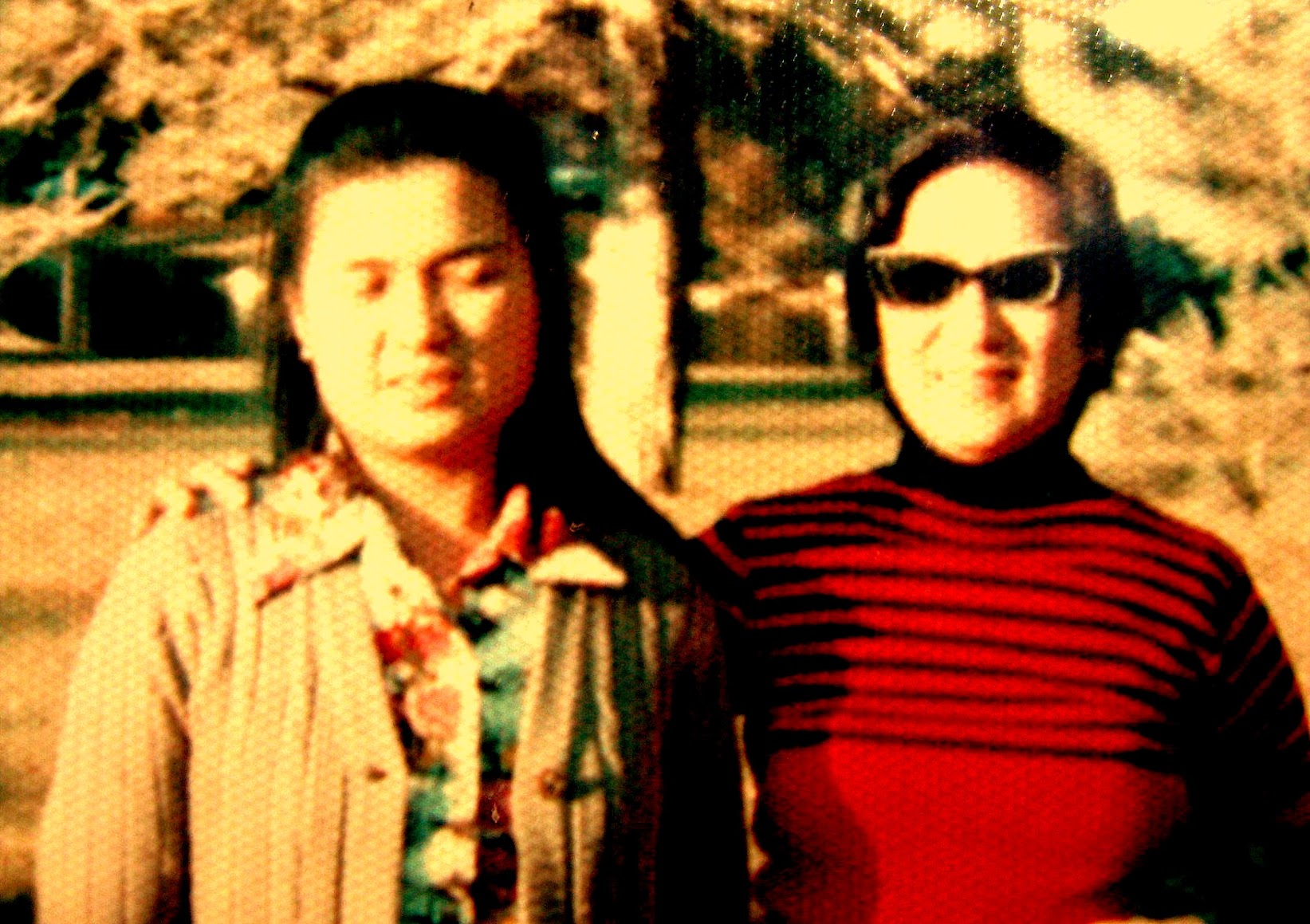  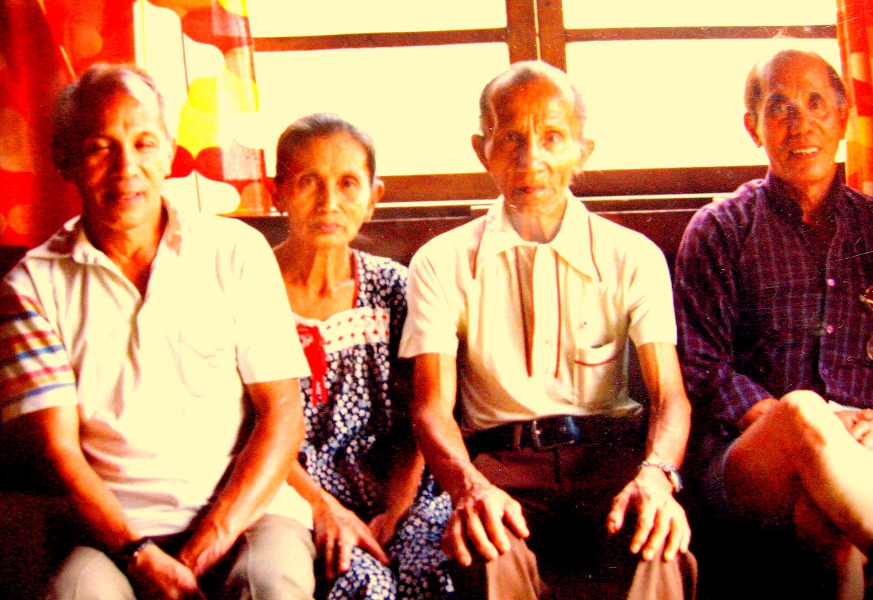   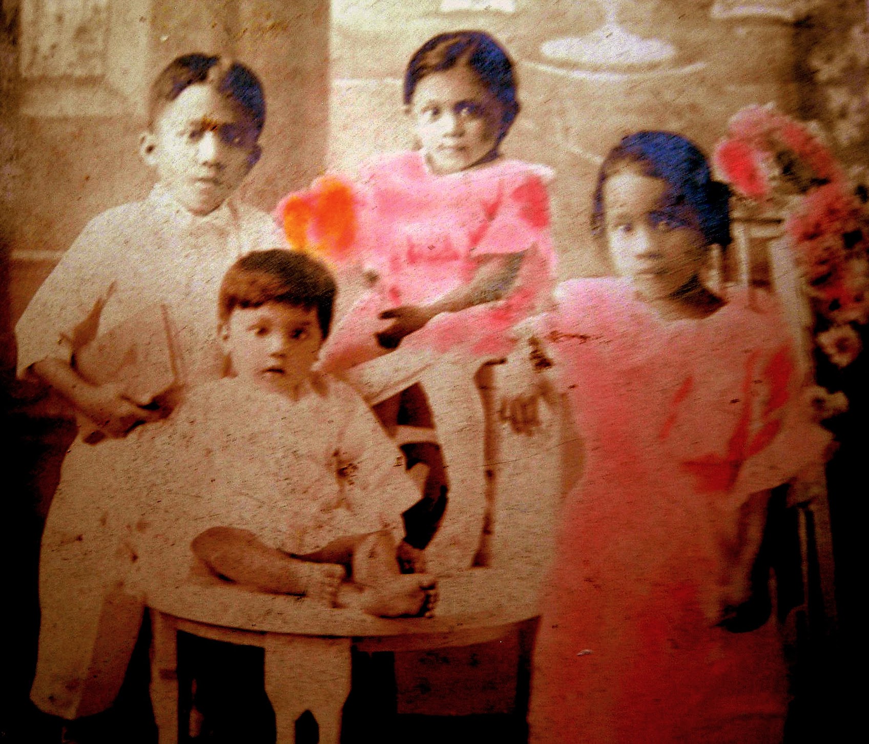         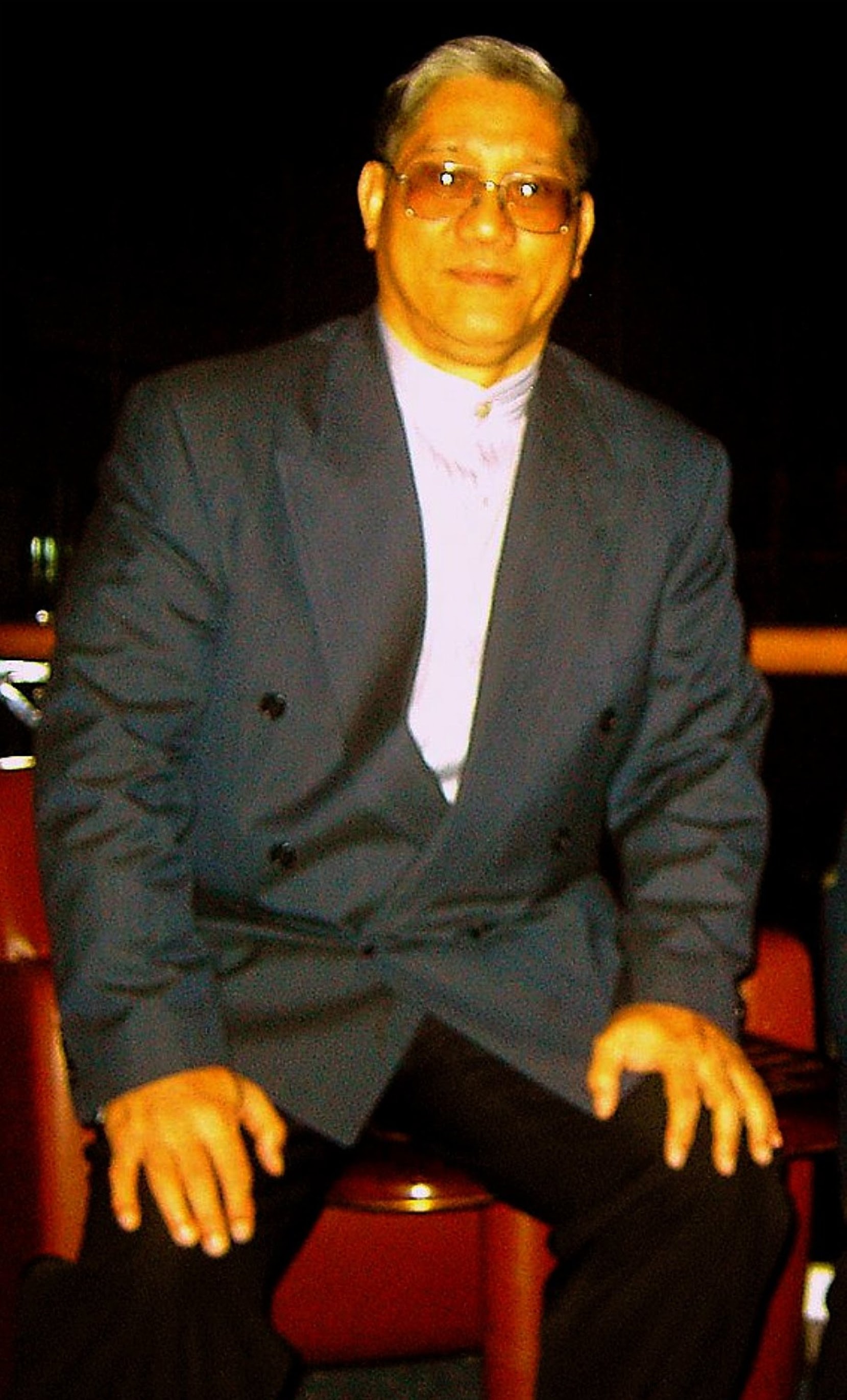 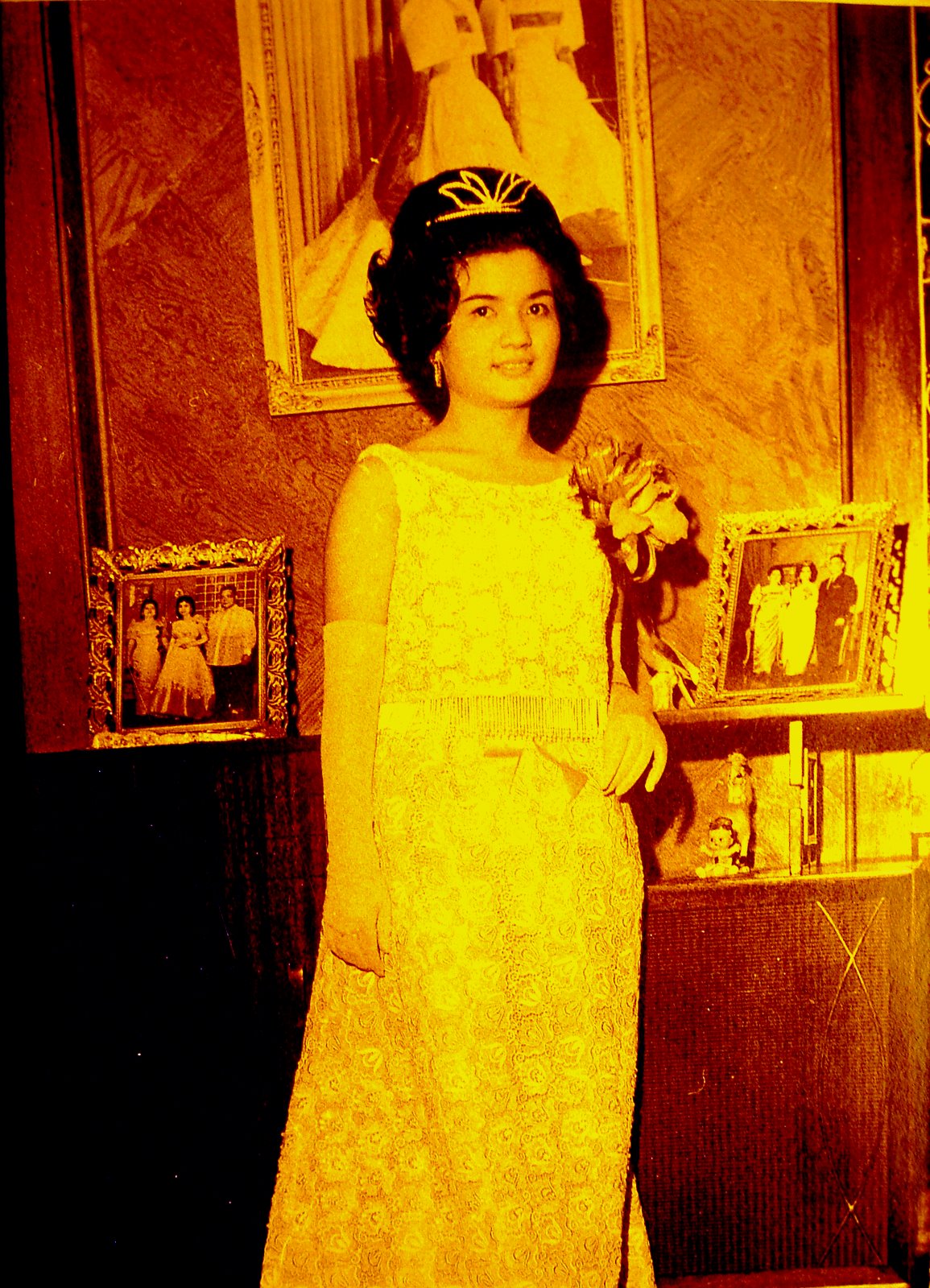 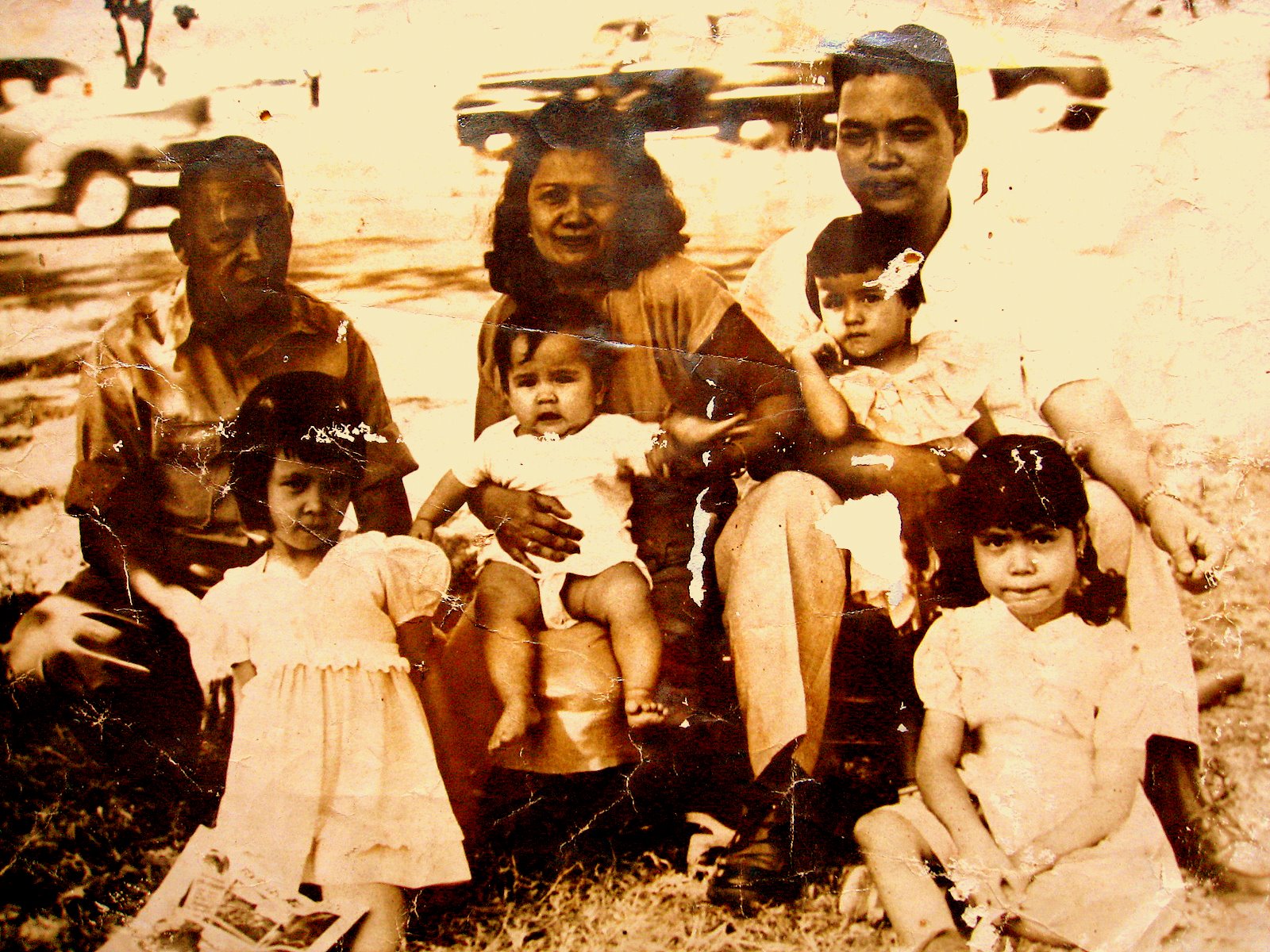  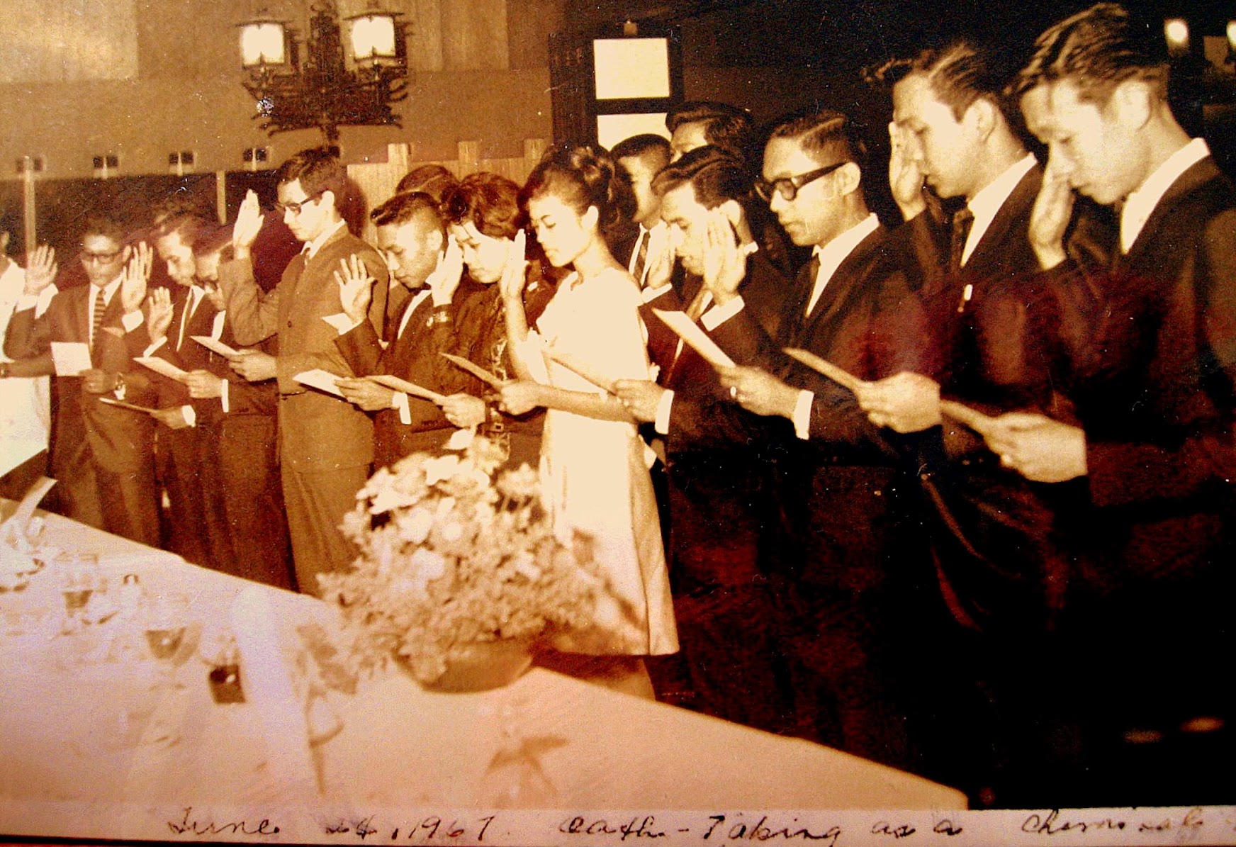     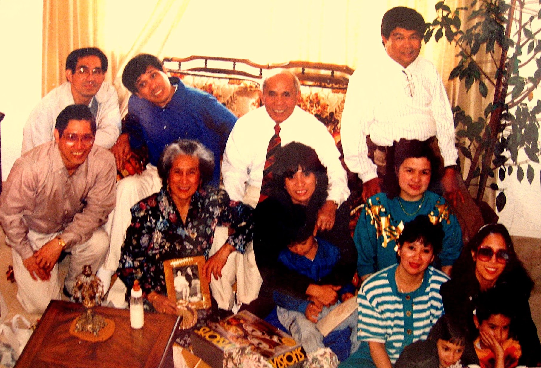                 |
 Bomod-ok Falls
|


-ANIMATION.gif)


-ANIMATION.gif)


.JPG)
.JPG)

.JPG)
.JPG)
.JPG)
.JPG)
.JPG)
.JPG)


Sarmiento Bldg, Makati, where I worked at Procter & Gamble;
 ARISTOCRAT. The closest restaurant to our place at MNS. 432 San Andres St. cor. Roxas Blvd., Malate |  
Top, movie houses, City Hall,
Right Photo Bagiuo, the terraces and the Lost highway bontoc-mainit (mountain province). A mountain trail in the Cordillera, Philippines.
Rizal Avenue the street was named after Rizal, it was referred to as Calle Dulumbayan. I watched movies at the Ideal, State, Dalisay and Avenue Theaters. Later on ... the Universal Theater and Odeon and Galaxy. And Scala, Apollo, Alegria and Opera House.
 |

Coast Guard Cutter in the Port Area, similar to ships we used to patrol offshore. Remnants of Daniel Burnham's stamp in Manila - the old Dewey Blvd. - now Roxas Blvd. Driving through the boulevard feels like driving through Chicago's Lake Shore Drive ... This picture of the boulevard feels like it was taken from a highrise on Chicago's Lake Shore Drive near Goethe and Inner Drive. The US Embassy is situated along this boulevard around the area of the lights jutting into the bay. Remnants of Daniel Burnham's stamp in Manila - the old Dewey Blvd. - now Roxas Blvd. Driving through the boulevard feels like driving through Chicago's Lake Shore Drive ... Actually Burnham designed plans for Manila (1905) before he designed Chicago (1909). Parts of the design, based on the City Beautiful movement were implemented - like this boulevard along Manila Bay. He also designed Baguio City, the summer capital of the Philippines, situated up in the mountains of Northern Philippines. |    |
On the foreground (right bottom) is one of the American colonial style buildings in the city of Manila ... that was a part of Daniel Burnham's plan for the Manila and most probably designed by Burnham's proteges. (This may be the old Finance Bldg.)
Escolta, Bergs on your right, Lyric movie theater further out to the right. Lyric Theater- a theater house that I used to get in and watch Splendor in the Grass, From Moment to Moment located in Escolta, Manila. It was owned and operated by Eastern Theatrical, Inc. At the far end of Escolta is one of the most beautiful streetscapes in the city with two breathtaking pre-World War II buildings facing each other: the Regina Building and the Perez-Samanillo.
Historic Quezon City. Manuel Quezon's burial monument located at Quezon City Circle, Quezon City, Philippines. Left Photo |  |
 Espirito Santo Church  | 
The place where the parish church of Espiritu Santo stands now was an old cemetery, officially closed by the Sanitary authorities already in 1913 due to the growing population in the vicinity. (There was a tree that served as an improvised belfry; on its branch hanged a bell. The two young seminarians studying at CTS, Juan Tugadi and Tomas Pacano, used to climb it to ring the bell. The two later became SVD priests.)
In January 1926, Archbishop Michael O.Doherty of Manila blessed the place where a church dedicated to the Holy Spirit was soon to rise. His Excellency gave a substantial donation for the construction of the church in the amount of P20,000.00. In 1928 our SVD missionaries started the construction of a church building. When Fr. William Finnemann was consecrated Auxiliary Bishop of Manila in 1929, Fr. Philip Beck took over as parish priest in December of 1931 - to him fell the burden of continuing the construction of the church. A crypt which contained 444 niches was built underneath the altar. The niches were sold to local residents and the proceeds used for the completion of the church. After much sacrifice and support from generous benefactors, parishioners and friends, the church was finally finished. It was blessed on the occasion of the parish fiesta on May 14, 1932 by Bishop William Finnemann himself - the first parish priest of Espiritu Santo Church.
|
February 9, 1946, the Capuchins obtained the official authorization from the government to restore the church of Lourdes in Intramuros. An official letter indicating the approval of the church and its condition, a plan of the church building was approved and signed on February 17, 1946. However, the Capuchins decided to build a beautiful and wide church in Quezon City, Retiro St. because Intramuros was a deserted place, abandoned by people and nobody’s land. The property of Intramuros where the Church of Lourdes and the Central House was sold to support the building of the new church at Quezon City.
Feast Day of Our Lady of Lourdes 1946 (Sta. Teresita Parish) |

 Altar at Our Lady of Lourdes retiro , Q.COne cannot mention the devotion to Our Lady of Lourdes in the Philippines without citing the people behind the devotion. It was a layman Don Regino Garcia who ordered the Filipino sculptor Manuel Flores to make a statue of Our Lady of Lourdes, which was placed at the side altar of the church of the Capuchins in 1892.March of the same year, the capuchins with the help of Fr. Mc Carthy, an Augustinian priest, brought the image of Lourdes to the University of Santo Tomas. During Palm Sunday of the same year, the image of saints are covered with veils by the Dominicans including the image of Lourdes and handed it over to the Capuchins and carried it to the chapel of Santa Teresita for the celebration of Flores de Mayo. Mass at Lourdes Shrine | 
It was during the Novena at Our Lady of Lourdes when the Japanese ordered all residents of Intramuros to go out of their houses and gather together at the four (4) main places of Intramuros: the Hollywood Theater, the San Agustin Church, the San Francisco Church and the Cathedral. Our Virgin of Lourdes and all the most necessary things were transferred from to altar to the receiving room of the convent of San Agustin Church. On February 11, the Feast of the Virgin of Lourdes, the capuchins and devotees appealed to the Japanese for permission to say 3 masses in the sacristy. The permit was granted, allowing 3 Superiors celebrating 3 masses for the feast: Franciscans, Augustinians and the Capuchins. How was the image of Lourdes was saved during the war?
Many people especially the devotees of Lourdes cried out to the capuchins to see the beautiful Virgin of Lourdes wondering how it was saved. According to history, when the capuchin brothers abandoned the church of Lourdes, Intramuros and the central house, they carried with them the image of Lourdes. Some days later, the Capuchin Custos, ,Fr. Florencio of Lezaun, gathered all religious articles: chalices, ciboriums, monstrances, relics and the treasure of the Virgin of Lourdes: crowns, rosaries and jewels. All together they put in iron box at the bank of D. Raimundo Salonga in Binondo. For the refuge of the Capuchin brothers, they were ordered by their superior to go to San Agustin and placed the images of Lourdes in the wide sacristy of the church. They continued on the daily novena exercises together with the religious of other orders and devotees including Doña Martina Azucena who was miraculously cured in 1896 before the image of Our Lady of Lourdes.
On February 23 of the same year, the image of Lourdes was abandoned in the sacristy of St. Augustine. Men young and old and the religious were horribly massacred by the Japanese sometime between January 5-19. Around 3500 women and children and all other refugees of St. Augustine were ordered to abandon the building. |  Lourdes Church FacadeOL of Lourdes Fiesta 2010, OL of Lourdes Shrine, Amoranto Ave., Q.C., Philippines |
 Old San Lazaro Hospital Ruins. Shrine of St. Lazarus, Avenida Rizal cor. Tayuman, Manila.The Manila Jai Alai Building was a building designed by American architect Welton Becket that functioned as a building for which jai alai games were held.[1] It was built in the Streamline Moderne style in 1940 and survived the Battle of Manila. It was considered one of finest Art Deco buildings in Asia. It was demolished on 2000 upon the orders of the Mayor of Manila Lito Atienza amidst protests, to make way for the Manila Hall of Justice, which was never built |
Summer of 1950 sparked the beginning of the Korean War. As a police action the United Nations sent 16 member nations to uphold peace and democracy in South Korea. One of these countries was the Philippines who arrived in September of 1950. Very little is known about the Philippines' participation in the Korean War, let alone the soldiers who fought for democracy. These are their memories, the memories of the Forgotten.
Jai Alai structure on Taft Avenue, photo at the right and below.
|  |
 Old San Lazaro Hospital Ruins Shrine of St. Lazarus, Avenida Rizal cor. Tayuman, Manila |  |

|  San Lazaro Leisure Park Race Track San Lazaro Leisure Park Race
The Jesuits built the first Roman Catholic Church in the area where the present Santa Cruz Parish stands on June 20, 1619. The Jesuits enshrined the image of the Our Lady of The Pillar in 1643 to serve the pre-dominantly Chinese residents in the area. The image drew a lot of devotees and a popular cult grew around it. On June 24, 1784, the King of Spain gave the deeds to about 2 km² of land that was part of the Hacienda de Mayhaligue to the San Lazaro Hospital which served as a caring home for lepers in Manila at that time. At the Santa Cruz Parish, a small park was built that linked the area into the headquarters of the Spanish cavalry, the building that once was the College of San Ildefonso, operated by the Jesuits. The district in the Spanish times also had a slaughter house and a meat market and up north was the Chinese cemetery. The Franciscan fathers were given the responsibility to care for the lepers of the city and specifically the San Lazaro Hospital. A Fr. Felix Huertas developed San Lazaro into a refuge for the afflicted and it became a famous home for those afflicted in the north side of the Pasig River.
47 Lincoln 76H Sedan with it's 292c.i. 2BBL 125 H.P. Flat Head V-12, 3 Speed Manual Transmission, Stock Rear Axle & Gear Ratio. The video above is the same as my first car. Like any boys yearning to have his wheels and freedom, I learned to drive at the age of 14 barely reaching the gas pedal and my head above the dashboard. Later I bought the car from my father at the measly sum of 100 pesos.
The Philippine General Hospital located on Taft Avenue beside my High School at Padre Faura was a public hospital but regardless was fortified by the Japanese in violation of the Geneva Convention. Inside there were many Filipino patients and several thousand Filipino refugees that were seeking what they thought would be safe shelter. On the roof on both ends there were large white circles with large red crosses. From Feb. 14 to Feb. 17, 1945 the Americans shelled the area. Some of the shells hit the buildings and many innocent Filipinos were injured and many lives were lost. Notice that the right end of the building was hit with an exploding shell. And notice a hole through the roof on the left end of the building in the white circle area close to the red cross where a shell hit but did not explode.
Tutuban Railroad Station
The construction of a railway line traversing the island of Luzon was initiated according to a plan submitted by Don Eduardo Lopez Navarro, then head of the Public Works Office. The line stretches from Tondo, Manila to Dagupan, Pangasinan. On July 31, 1887, the cornerstone of the Tutuban Station was laid by General Emilio Terrero, marking the start of the railroad track.
When the PNR began its operations on November 24, 1892, Tutuban Station became a place of business. It opened its doors to businessmen coming from different parts of Manila. Commerce played a large role in awareness about Tutuban, and it served as an important trading complex due to its very strategic location in Divisoria. Produce coming in by bulk from several provinces are unloaded in the station, and then distributed to retailers awaiting at the station.
The etymology for the name “Tutuban” was believed to have come from the sounds made by the locomotives stationed in the area. However, the word actually comes from “tuba,” the name of the local alcoholic drink made from coconuts, since previously Tutuban was the center of production of this beverage. Natives referred to the place as Tubaan ... meaning a place where the "tuba" (native alchoholic beaverage) came from.
Tutuban Station is also famous for being the birthplace of the revolutionary Andres Bonifacio. In commemoration, a monument stands in the current mall's plaza.

Tanay Lighthouse
|  Jai Alai Jai Alai San Lazaro Leisure Park Race Track Hauling Manila hemp fiber to market,
Binondo Church is located in Manila's Chinatown at the western end of Ongpin Street, Binondo. This church was founded by Dominican priests in 1596 to serve their Chinese converts to Christianity. The original building was destroyed by a bombardment by the British in 1762 during their brief occupation of Manila at that time. The current granite church was completed on the same site in 1852 and features an octagonal bell tower which suggests the Chinese culture of the parishioners. Binondo Church was greatly damaged during the Second World War, although fortunately the western facade and the octagonal bell tower survived.
Binondo Church is also known as the Minor Basilica of San Lorenzo Ruiz. It was named after the sacristan, San Lorenzo Ruiz, who was born of a Chinese father and a Filipino mother, trained in this church and afterwards went as a missionary to Japan and was executed there for refusing to renounce his religion. San Lorenzo Ruiz was to be the Philippines' first saint and he was canonized in 1989. A large statue of the martyr stands in front of the church. Masses are held in Filipino, in Chinese dialects (Mandarin, Hokkien), and in English.   I worked here during my college days at Iwaii & CO. Bank of the Philippine Islands at Don Roman Santos Building (a neo-classical, Graeco-Roman architecture at Plaza Goiti (now Plaza Lacson) in Sta. Cruz.  Old Tutuban Railway Station Old Tutuban Railway Station
Tanay, lake meets the mountain |


 |  Sampaloc, Tanay. Tanay is a first class municipality in the province of Rizal, Philippines. It is located 57 kilometres (35 mi) east of Manila, although a typical commute between Manila and Tanay will take between one to three hours depending upon traffic conditions. It contains portions of the Sierra Madre Mountains and is bordered by Antipolo City in the northwest, Baras, Morong and Teresa in the west, General Nakar (Quezon Province) in the east, and Pililla, Santa Maria (Laguna province) as well as the lake Laguna de Bay in the south. According to the latest census, it has a population of 94,460 people in 15,720 households. The majority of the population consists of Tagalogs who live near Laguna de Bay, though there is also a significant percentage of mountain dwelling people living in the northern portions of the municipality. The town's major trades consist of fishing, agriculture and regional commerce. Tanay is also believed to be the birthplace of the Sambal language and myself too.  |  Tanay Church in RizalTanay Church in RizalTanay Church in Rizal The plaza fronting the church. |
 This is the only restaurant that can compete with Auntie Auroring’s pancit mami  Manila Harbor, and Intramuros, Philippines, early 1960s Notice that this photo was taken before much rebuilding in Intramuros and there is lots of empty land showing just how much of the city was cleared after WWII. |  |
|


 ……………
……………


The gate of Fort Santiago during World War II
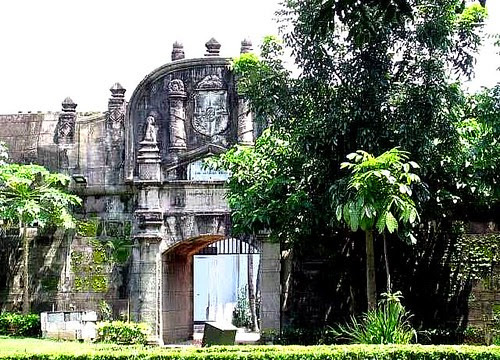
Taken from Fort Santaigo, Fort Santiago is a citadel first built by Spanish conquistador, Miguel López de Legazpi for the new established city of Manila in the Philippines. The defence fortress is part of the structures of the walled city of Manila called Intramuros ( within the walls ). The fort is one of the most important historical sites in Manila. Several lives were lost in its prisons during the Spanish Colonial Period and World War II. José Rizal, the Philippines' national hero, was imprisoned here before his execution in 1896. The Rizal Shrine museum displays memorabilia of the hero in their collection and the fort features, embedded onto the ground in bronze, his footsteps representing his final walk from his cell to the location of the actual execution. The fort was named after Saint James the Great ( Santiago in Spanish ), the patron saint of Spain, whose relief adorns the facade of the front gate. It is located at the mouth of the Pasig River and served as the premier defence fortress of the Spanish Government during their rule of the country. It became a main fort for the spice trade to the Americas and Europe for 333 years. The Manila Galleon trade to Acapulco, Mexico began from the Fuerza de Santiago.
The fort has a perimeter of 2,030 feet ( 620 m ), and it is of a nearly triangular form. The south front, which looks toward the city, is a curtain with a terreplein, flanked by two demi-bastions - the Bastion of San Fernando, on the riverside, and the Bastion of San Miguel, by the bay side. A moat connected with the river separates the fort from the city. Near the beginning of the north face, instead of a bastion, a cavalier called Santa Barbara was built with three faces of batteries, one looking seaward over the anchorage place, one facing the entrance, and the third looking upon the river. The latter is united with a tower of the same height as the walls, through which there is a descent to the water battery placed on a semicircular platform, thus completing the triangular form of the fort.
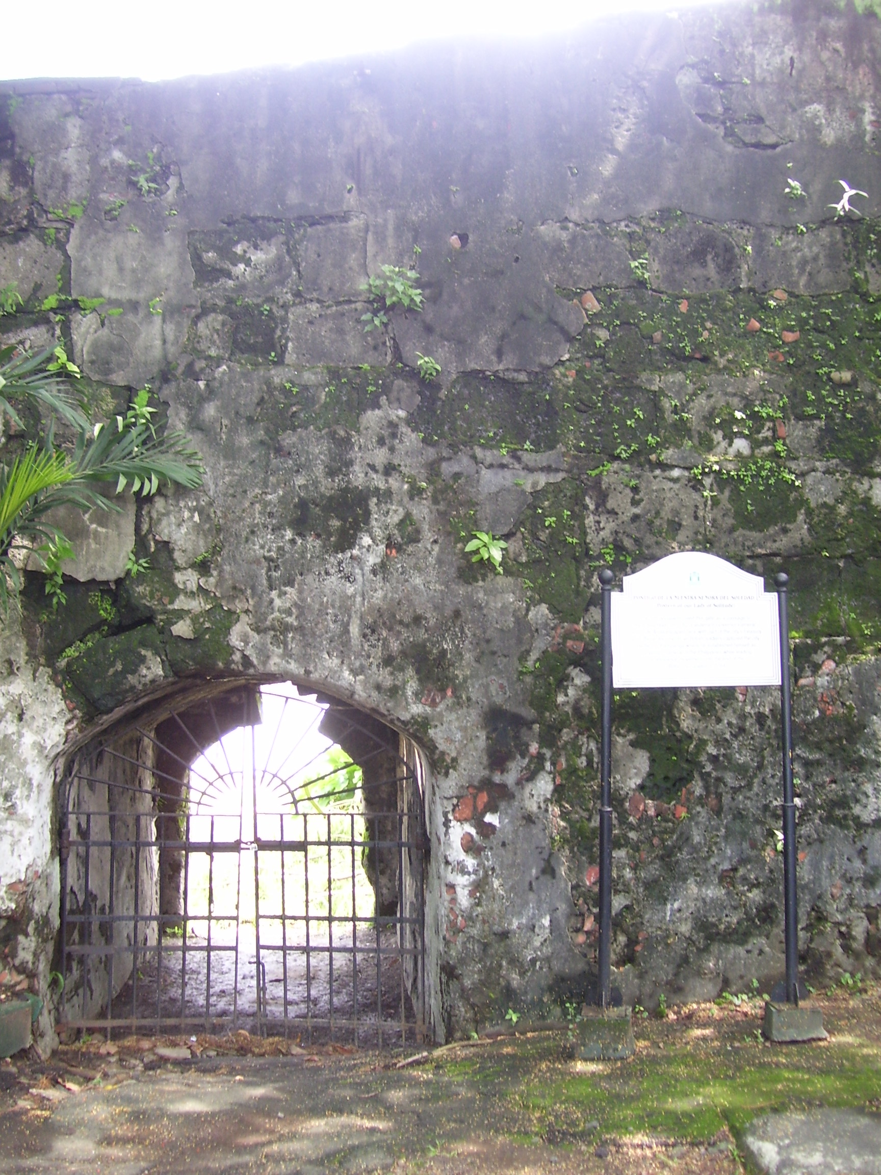
The 22-foot ( 6.7 m ) high walls, with a thickness of eight feet ( 2.4 m ) are pierced for the necessary communications. The front gateway facade measures 40 feet ( 12 m ) high being in the south wall and facing the city. The communication with the river and the sea was by an obscure postern gate - the Postigo de la Nuestra Señora del Soledad ( Postern of Our Lady of Solitude ). Inside the fort were guard stations, together with the barracks of the troops of the garrison and quarters of the warden and his subalterns.
The fort has a perimeter of 2,030 feet ( 620 m ), and it is of a nearly triangular form. The south front, which looks toward the city, is a curtain with a terreplein, flanked by two demi-bastions - the Bastion of San Fernando, on the riverside, and the Bastion of San Miguel, by the bay side. A moat connected with the river separates the fort from the city. Near the beginning of the north face, instead of a bastion, a cavalier called Santa Barbara was built with three faces of batteries, one looking seaward over the anchorage place, one facing the entrance, and the third looking upon the river. The latter is united with a tower of the same height as the walls, through which there is a descent to the water battery placed on a semicircular platform, thus completing the triangular form of the fort.
The 22-foot ( 6.7 m ) high walls, with a thickness of eight feet ( 2.4 m ) are pierced for the necessary communications. The front gateway facade measures 40 feet ( 12 m ) high being in the south wall and facing the city. The communication with the river and the sea was by an obscure postern gate - the Postigo de la Nuestra Señora del Soledad ( Postern of Our Lady of Solitude ). Inside the fort were guard stations, together with the barracks of the troops of the garrison and quarters of the warden and his subalterns.

Ferry, Pasig river.Makati, Manila,
Also inside the fort were various storehouses, a chapel, the powder magazine, the sentry towers, the cisterns, etc. The location of Fort Santiago was once the site of a palisaded fort, armed with bronze guns, of Rajah Sulaiman, a Muslim chieftain of pre-Hispanic Manila. It was destroyed by maestre de campo ( master-of-camp ) Martin de Goiti who, on arriving in 1570 from Cebu, fought several battles with the Islamic natives. The Spaniards started building Fort Santiago ( Fuerza de Santiago ) after the establishment of the city of Manila under Spanish rule on June 24, 1571, and made Manila the capital of the newly colonized country.
The first fort was a structure of palm logs and earth. Most of it was destroyed when the city was invaded by Chinese pirates led by Limahong. Martin de Goiti was killed during the siege. After a fierce conflict, the Spaniards under the leadership of Juan de Salcedo, eventually drove the pirates out to Pangasinan province to the north, and eventually out of the country. The construction of Fort Santiago with hard stone, together with the original fortified walls of Intramuros, began in 1590 and finished in 1593 during the reign of Gomez Perez Dasmariñas. The stones used were volcanic tuff quarried from Guadalupe ( now Gualupe Viejo in Makati ). The fort as Dasmariñas left it consisted of a castellated structure without towers, trapezoidal in trace, its straight grey front projecting into the river mouth. Arches supported an open gun platform above, named the battery of Santa Barbara, the patron saint of all good artillerymen. These arches formed casemates which afforded a lower tier of fire through embrasures. Curtain walls of simplest character, without counter forts or interior buttresses, extended the flanks to a fourth front facing the city.


Manila

Some fruit in baskets.

Atis fruitAnnona squamosa (also called sugar-apple, or sweetsop) is a species of Annona native to the tropical Americas and widely grown in El Salvador, India, Pakistan and the Philippines. Its exact native range is unknown due to extensive cultivation, but thought to be in the Caribbean; the species was described from Jamaica. 
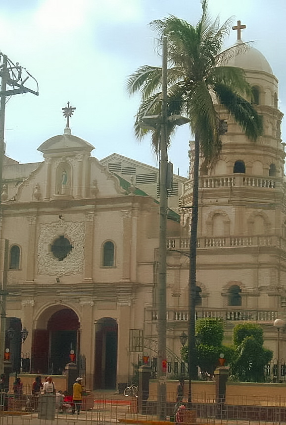
Tanay San Ildefonso Church
 Plaza Sta Cruz. Prior to the arrival of the Spanish conquistadors to the Philippine Islands, the district of Santa Cruz was partly a marshland, patches of greeneries, orchards and partly rice fields. A Spanish expedition in 1581 claimed the territory and awarded to the Society of Jesus or more commonly called the Jesuits |
 Regina Building. This building is one of the few American Era buildings that remained along Calle Escolta. Regina bldg. right photo.Roman Santos Building
The Heritage Bells, the bigger one cast in 1832, the other one fifty years later, were once used to signal the start and end of classes at the Ateneo de Manila campuses in Intramuros and Padre Faura St. During my High School days, the basket ball court at Ateneo was always our venue, most probably due to the trees which shaded the court. The Padre Faura campus continued to house the professional schools until 1976. Fr. Francisco Araneta, S.J. was appointed as the Ateneo de Manila's first Filipino Rector in 1958. In 1959, its centennial year, the Ateneo became university.
 |
 Manila Harbor, and Intramuros, Philippines, late 1950s or early 1960s. Notice that this photo was taken before much rebuilding in Intramuros and there is lots of empty land showing just how much of the city was cleared after WWII. |


 Port Area, Manila Port Area ManilaWhich ever way ...Different kinds of transportation to bring in and bring out people to and from the island of Cebu in the Philippines. Coast Guard Port Area Manila End of Day Sun just about to disappear from the horizon. The ship on the foreground is the PMI training ship.
Luzon, Sagada is nestled in a valley at the upper end of the Malitep tributary of the Chico River some one and a half kilometers above sea level in the central Cordillera; enveloped between the main Cordillera Ranges and the Ilocos Range. Mt. Data in the south and Mt. Kalawitan in the southeast pierce the horizon. Mt. Polis, Bessang and Mt. Tirad in the east, and Mt. Sisipitan in the north mark the Mountain Province - Abra boundary.
Kalinga-Apayao Province The Banaue Rice Terraces (Tagalog: Hagdan-hagdang Palayan ng Banawe) are 2000-year old terraces that were carved into the mountains of Ifugao in the Philippines by ancestors of the indigenous people. The Rice Terraces are commonly referred to by Filipinos as the "Eighth Wonder of the World". It is commonly thought that the terraces were built with minimal equipment, largely by hand. The terraces are located approximately 1500 meters (5000 ft) above sea level and cover 10,360 square kilometers (about 4000 square miles) of mountainside. They are fed by an ancient irrigation system from the rainforests above the terraces. It is said that if the steps are put end to end it would encircle half the globe.Contrary to popular belief, the Banaue Rice Terraces are not part of the Rice Terraces of the Philippine Cordilleras UNESCO inscription but are declared a National Cultural Treasure as the Ifugao Rice Terraces. Ancient sprawling man-made structures from 2,000 to 6,000 years old, other terraces are found in the provinces of Kalinga, Apayao, Benguet, Mountain Province and Ifugao. But only those in Batad, Bangaan, Mayoyao, Hungduan and Nagacadan, all in Ifugao, are inscribed as a UNESCO World Heritage Site.battery grudds | 
Eisenhower visit. I was there observing the motorcade as a sophomore at U.P. Prep. Luneta below. This was the Luneta I remember ... I was in my 2nd year High School at the University when "Ike" visited the Philippines. ... of course Ike used to live here before the 2nd WW when Philippines was a Commonwealth of the United States and was aid to the Field Marshal ...now President of the USA.


|


 |
 |

|

 CHINA TOWN
1

Pre-Hispanic period
Before the first arrival of Europeans on Luzon island, the island was part of the Majapahit empire around the 14th century, according to the epic eulogy poem Nagarakretagama which described its conquest by Mahārāja Hayam Wuruk. The region was invaded around 1485 by Sultan Bolkiah and became a part of the Sultanate of Brunei. The site of Intramuros then became a part of the Islamic Kingdom of Maynila ruled by various Datus, Rajas and the Sultan.

Construction of the defensive walls was started by the Spaniards in the late 16th century to protect the city from foreign invasions. The 0.67-square-kilometre (0.26 sq mi) walled city was originally located along the shores of the Manila Bay, south of the entrance to Pasig River. The reclamations during the early 20th-century obscured the walls from the bay. Guarding the old city is Fort Santiago, its citadel located at the mouth of the river. Intramuros was heavily damaged during the battle to recapture the city from the Japanese Imperial Army during the Second World War. Reconstruction of the walls was started in 1951 when Intramuros was declared a National Historical Monument, which is continued to this day by the Intramuros Administration
|  Intramuros - Manila Hotel
Intramuros is the oldest district and historic core of Manila, the capital of the Philippines. Known as the Walled City, the original fortified city of Manila was the seat of the Spanish government during the Spanish colonial period. The walled part of Manila was called intramuros, which is Latin for "within the walls"; districts beyond the walls were referred as the extramuros of Manila, meaning "outside the walls"
The Manila Hotel which opened in 1912 and extensively remodeled in the 1970s is a Philippine landmark, home to high society and to political intrigue, and often a scene of historic events.
1898- Judge William Howard Taft issued of the first decrees of the Second Philippine Commission, to create an urban plan for the Manila. Architect and city planner Daniel Hudson Burnham drafted a wide and long tree-lined boulevard that would begin at the park and at the spit’s end of the bay, a boulevard that would be dominated on one end by a hotel.
1908- William Parsons was appointed to continue where Burnham left off. He supervised the design and construction of Manila Hotel and was completed four years later. Soon, a magnificent, white, green-tile-roofed California Missionary-styled edifice emerged housing 149 spacious and high-ceilinged rooms. Since then, it is a hotel that commands the best westward view of Manila’s fabled sunset, the fortress of Corregidor, the poignant ruins of the medieval fortress that was Intramuros, and the palm-lined promenades of Luneta Park.
|
 |  |
1960: Pasig River still alive then, now heavy polluted and black in color. The Pasig River was a clear, flowing body of water that served as the center of commerce in Spanish colonial Manila. Stretching 27 kilometers, it connects Laguna Lake to Manila Bay and was the major source of water and livelihood of the many communities along its banks. People washed clothes in the shallower waters and fisher folks’ daily catch were always bountiful. The passenger boats that plied the river from the nearby province of Laguna to Manila and back served as the primary means of transportation. Today’s generation, however, has no recollection of the Pasig River in its heyday. Sunset at Manila Bay where the Pasig River empties.
In my late sixties, I begin to see the value of childhood memories, as a legacy worth sharing it to my family and that I, hopefully, will not be forgotten when I leave this physical world.
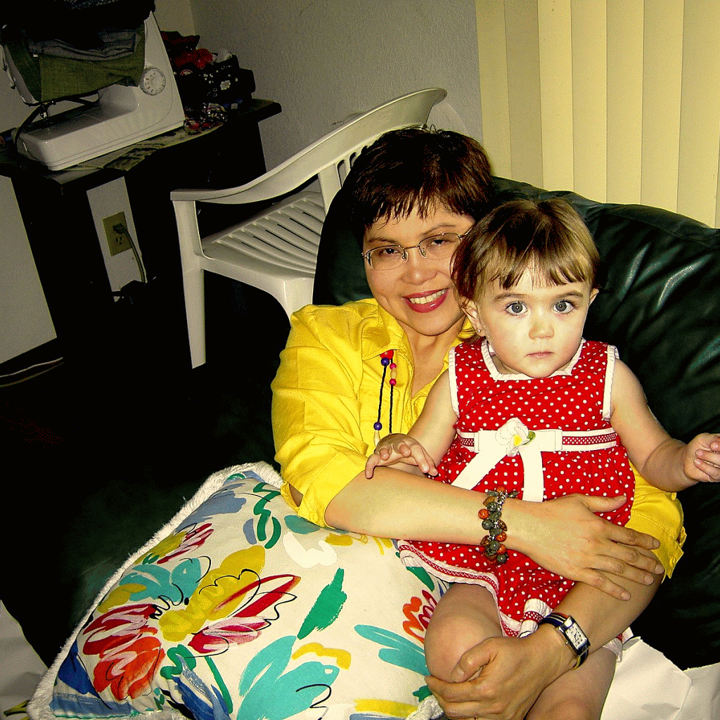
My consciousness started on a bright November day in 1946 at the age of two. I experienced my new relation with my sister Aleta newly arrived from the hospital the night before. On this early morning, while waking from deep sleep in the bedroom, I saw my mother and the new born baby. I stood up watched my sister take my place as the new “baby” supposed with the jealousy of a child wondering what his new status is.
At a distance I could see my mother's pretty face nourishing my little sister, as I ran toward her. I can only imagine her smiling face filled with assurance to know how I felt, tinge with a fear of rivalry, little legs running toward her.
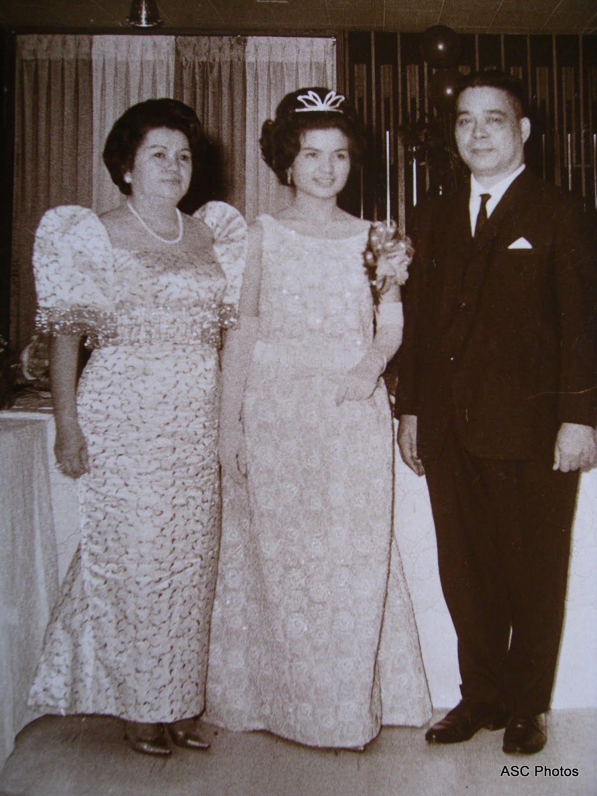
Right photo, one month before Aleta was born, bottom photo further down taken at graduation from Grade 7, March 17, 1957.
| 
Angeles del Pilar ……..1919-1994
I have always regarded my mother as the most patient, gentle and beautiful person in my life. She was my model during my search for my future wife. As a little child I loved her most of all, now that I am old, my love for her has grown beyond this world. I terribly miss her presence and tender care.
 |


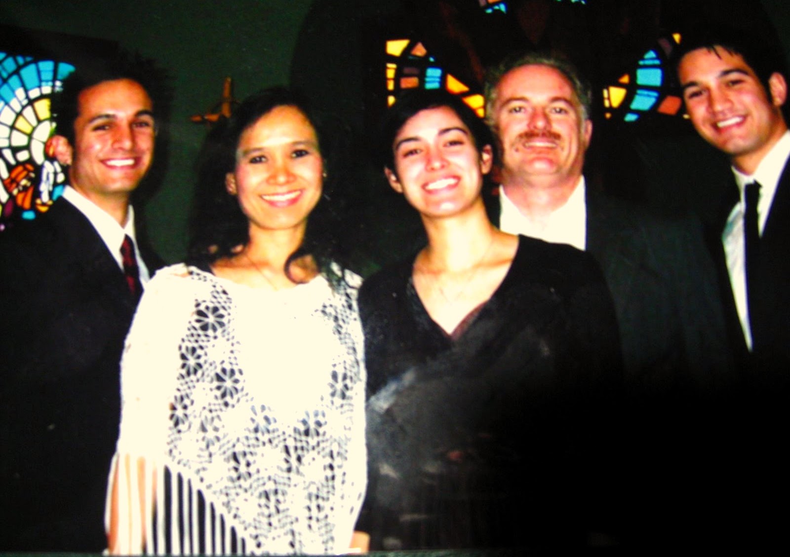
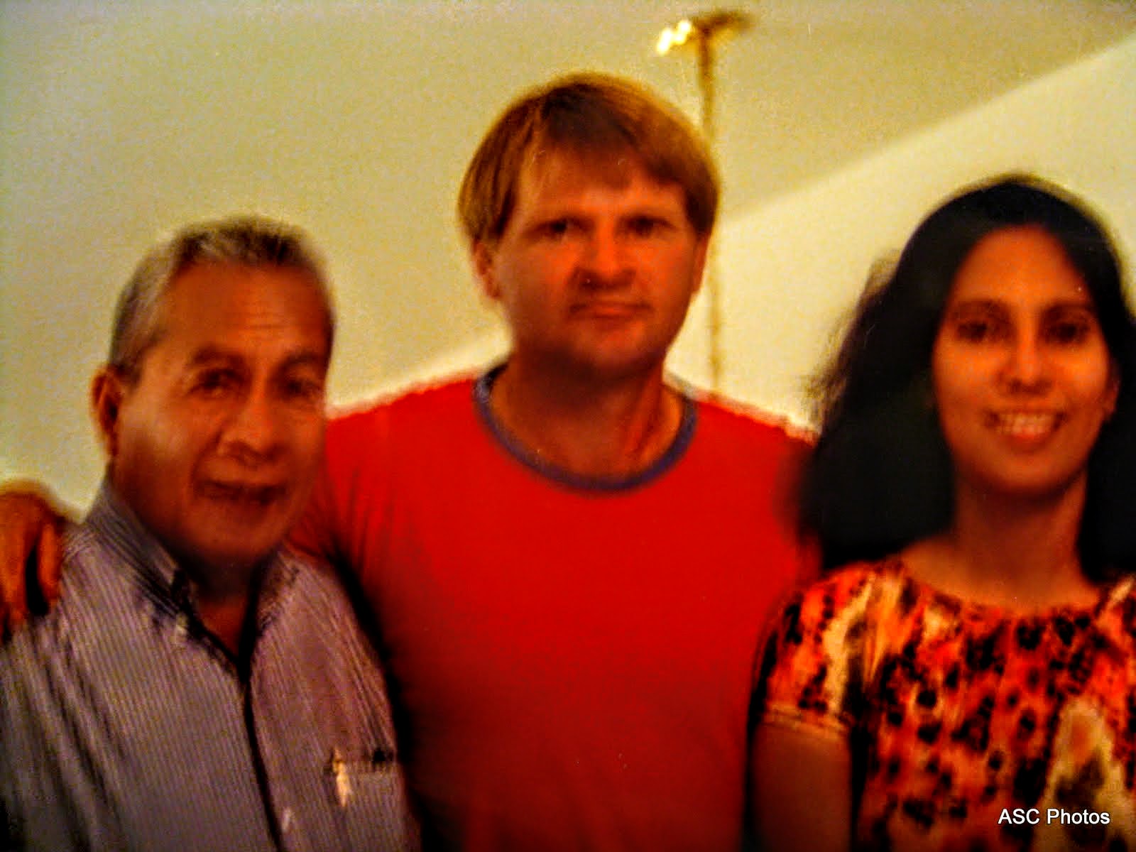
Among first cousins at a wedding of Josephine who passed away Jan 1, 2014 RIP. I am the 3rd boy to the right.
 I graduated right in front of this building with class 1966 ChE and Carlos P. Romulo as guest speaker. The Institute is a reputable source of architects, engineers, and science graduates and constantly produces top notchers in the architectural and engineering fields |
In 1951, the Mapúa family acquired a piece of land from the La Corporación Fransicana where the present Intramuros Campus stands. The campus opened at 1956 while the building construction were completed in 1963. All college programs were transferred from the Doroteo José campus to the Intramuros Campus in 1973. During my stay, the Institute consistently dominated the top 10 and even the top 20 slots in most licensure exams for architecture and engineering, year after year. It also consistently achieved the highest passing rates in the board exams among other competing schools in architecture and the various fields of engineering.
|
| I always pass by these golf course on Mckinley Road. What I remember most was the abundance of huge acacia trees and vegetation that made the place cool. Established in 1901, this is undoubtedly Manila's preeminent golf club. The 18-hole course is impeccably maintained, while the clubhouse features a coffee shop, a restaurant and a gym for the relaxation of members. We learn more of our true history in our social intercourse on rural justice more than the news/books from the Western Media in our classroom years. We were somewhat brainwashed to think that people who fight to uplift themselves from social oppression were all bad. To look at the true story of the HUK Insurrection in the Philippines, is to open both sides of society, the poor and the rich. |
|
Chapel Sculpture Facade of the 60-ft tall chapel of the American Cemetery in Fort Bonifacio, Taguig City. The sculpture represents, from bottom to top, the young American warrior symbolized by St George, fighting his enemy, the dragon, in the jungle. Above them are the ideals for which he fought: Liberty, Justice, Country. Columbia, with the child symbolizing the future, stands at the zenith. Information sourced from the Manila American Cemetery and Memorial pamphlet. High Noon at the Batttlefield
Right hemicycle of the Manila American Cemetery, viewed from the entrance of the left hemicycle. The gap between the gray pebbles is the path to the memorial's chapel. For more information, please see
In MemoriamOpposites
Shot at the Manila American Cemetery. The brownish smooth hardness of the limestone tablets against the dark, disordered patterns of the tree's foliage. Order and disorder. Life. Gone, and the living.
Wall of the Missing. Continuing with the B&W project. Shot at the Manila American Cemetery in Fort Bonifacio, Taguig City. As the sun gently sinks, the shadows slowly draws across the names of the missing valiant - exactly 36,286 American and Filipino servicemen are recorded in these limestone tablets.Manila American Cemetery and MemorialManila American Cemetery and Memorial is located in Fort Bonifacio, Taguig City in Metro Manila, Philippines.Manila American Cemetery and MemorialNave Chapel of Our Lady of the Miraculous Medal, Philippine Women's University, Manila, PhilippinesPasig River viewed from old Ayala Bridge Puerta de Isabel Gate through the old Spanish Wall, Intramuros, ManilaPuerta Postigo del Palacio Gate, Intramuros, Manila, PhilippinesThe awesome interior of old Binondo Church ( Basilica of San Lorenzo Ruiz ) .... the patroness of this historic Dominican Church is the Nuestra Senora Del Rosario . In College, I worked in this building with an export import company. | 
|
-ANIMATION.gif)

My early socialization with non relatives of my age started within the elementary School from Grade 1 to 7. It was 1950, 5 years after the war, when I started schooling. The limited amount of classroom space was clearly evident then for the newly established Parochial School. It did not bother me about the location, maybe of my innocence about the specter of death, as we have our class inside the catacombs at the basement of Espirito Santo Church. I can recall the names of my favorite girl classmates, just like yesterday. To me, they seem to be much nicer, more intelligent than what I feel about the boys. My early perceptions of the bullies in the class, that they were probably motivated by competition for attention, and reminder of who rules among the boys. Those who feel superior though, was never given any quarter, as I have that early sense of justice given to the underdog. So it follows in the years, how many scraps I have to go thru. This is the same all through High School. It is also a lesson to know about myself, as my motivation to study depends on who my teacher was. The more attractive she was the more studious I became.
What I remember about Espiritu Santo Parochial School: it was formally established in 1947 by Rev. Fr. William J. Duschak, SVD, former Vicar Apostolic of Calapan, Oriental Mindoro. Initially, classes were held in the parish hall. Due to the unprecedented increase in student enrolment, the high school department, the Annex 1 and the Annex II buildings were constructed in succession. The following years, Fr. Antonio Albrecht, SVD, the Holy Spirit Sisters and the Secular Clergy efficiently administered the operation of the school. In 1973, the Religious Missionaries of St. Dominic took over its management.
Our song…… E.S.P.S. all praise to thee Glad the song we raise to thee. Down the years we’ll love thy name. Thy renown we’ll all acclaim. Thy love and truth will ever be Stars to guide our loyalty A light to shine . . . . on life’s high sea Alma Mater ESPS. Sons and daughters sing to thee, Worthy gifts we bring to thee. Hearts we give thee loyal truth To those rare gifts we owe to you.
|
Rizal Hall, University of the Philippines
Independent Philippines and the Third Republic (1946-1972). In April 1946, elections were held. Despite the fact that the Democratic Alliance won the election, they were not allowed to take their seats under the pretext that force had been used to manipulate the elections. The United States withdrew its sovereignty over the Philippines on July 4, 1946, as scheduled.
Manuel Roxas (Liberal Party), having been inaugurated as President as scheduled, on July 4, 1946 before the granting of independence, strengthened political and economic ties with the United States in the controversial Philippine-US Trade Act, In Mar., 1947, the Philippines and the United States signed a military assistance pact (since renewed) which allowed the US to participate equally in the exploitation of the country's natural resources—and rented sites for 23 military bases to the US for 99 years (a later agreement reduced the period to 25 years beginning 1967). These bases would later be used to launch operations in the areas of Korea, China, Vietnam, and Indonesia. During the Roxas administration, a general amnesty was granted for those who had worked together with the Japanese while at the same time the Huks were declared illegal. His administration ended prematurely when he died of heart attack April 15, 1948 while at the US Air Force Base in Pampanga. Vice President Elpidio Quirino (Liberal Party, henceforth referred to as LP) was sworn in as President after the death of Roxas in April 1948. He ran for election in November 1949 against Jose P. Laurel (Nacionalista Party, henceforth referred to as NP) and won his own four-year term. During this time, the CIA under the leadership of Lt. Col. Edward G. Lansdale was engaged in paramilitary and psychological warfare operations with the goal to hold back the Huk Movement. Among the measures which were undertaken were psyops-campaigns which demoralized the superstition of many Filipinos and acts of violence by government soldiers which were disguised as Huks. By 1950, the U.S. had provided the Philippine military with supplies and equipment worth $200 million dollars. The huge task of reconstructing the war-torn country was complicated by the activities in central Luzon of the Communist-dominated Hukbalahap guerrillas (Huks), who resorted to terror and violence in their efforts to attain land reform and gain political power. They were finally brought under control (1954) after a dynamic attack introduced by the minister of national defense, Ramón Magsaysay. By that time Magsaysay was president of the country, having defeated Quirino in Nov., 1953. His campaign was massively supported by the CIA, both financially and through practical help in discrediting his political enemies. He had promised sweeping economic changes, and he did make progress in land reform, opening new settlements outside crowded Luzon Island. His death in an airplane crash in Mar., 1957, was a serious blow to national morale. Vice President Carlos P. García succeeded him and won a full term as president in the elections of Nov., 1957. In foreign affairs, the Philippines preserved a firm anti-Communist policy and joined the Southeast Asia Treaty Organization in 1954. There were difficulties with the United States over American military installations in the islands, and, in spite of formal recognition (1956) of full Philippine sovereignty over these bases, tensions increased until some of the bases were dismantled (1959) and the 99-year lease period was reduced. The United States rejected Philippine financial claims and projected trade revisions. Philippine opposition to García on issues of government corruption and anti-Americanism led, in June, 1959, to the union of the Liberal and Progressive parties, led by Vice President Diosdado Macapagal, the Liberal party leader, who succeeded García as president in the 1961 elections. Macapagal’s administration was marked by efforts to combat the mounting rise that had plagued the republic since its birth; by attempted alliances with neighboring countries; and by a territorial argument with Britain over North Borneo (later Sabah), which Macapagal claimed had been leased and not sold to the British North Borneo Company in 1878.
Inside the walls of Intramuros, The location of MIT.One of the seven Gates. The construction of Intramuros started in 1571 by Miguel Lopez de Legaspi, a Spaniard. The walled city covers an area of about 160 acres. Intramuros was a fortress city with walls 6 metres high and a commanding 3 kilometres in length, it is no wonder it was impenetrable. Only the Spanish elite and Mestizos (mixed race) were permitted to live inside Intramuros, where at night the city gates were locked down.
intramuros, manila cathedral
The natives and Chinese were not permitted to live inside the walled fortress and were resigned to live outside the great walls of Intramuros. Intramuros was designed with 51 blocks within the vast walls, the only access in or out of Intramuros was via seven fortified gates. A moat around the walled city was added in 1603. Spread throughout the 51 blocks of the city were 12 churches, hospitals, domestic accommodation, military barracks, Governors Palace and schools.
My Church in the town of my birth:Tanay, Built in 1778, the church was named after the Archbishop Ildefonso of Toledo, Spain, who was consecrated during the year 657 AD; revered for his spiritual vitality and deep writings contained in “ The Book of the Virginity of Maria”. Behind the heavy stone edifice decorated with Hispanic, archetype windows and stone sculpture of its saint, are legends that found its way to this generation. Tradition has it that an image of the Lady of the Immaculate Conception, was found among the belongings of our fleeing forefathers on the onset of the Spanish Invasion in 1573; the same image found among the remnants from the fire that gutted the first church in 1620- a lone survivor! During the Chinese Uprising in 1639, Father Geronimo de Frias hid it in the fields but was later on found by the Chinese rebel who tried to destroy the image, instead to themselves befell violent death.
Cross at Bukal, in Tanay
This was always sang to me by my grandmother. Presented in this video are the vintage photographs of the following colonial and historical religious edifices:
1. La Loma Church - formerly Caloocan, now Manila 2. Sto Domingo Church- Intramuros (destroyed by the Americans during world war II) 3. Paco Catholic Cemetery - Paco 4. Tondo Church -Tondo 5. San Sebastian Church -Manila 6. Binondo Church - Binondo 7. San Juan Church - San Juan 8. Sta. Cruz Church - Manila 9. Manila Cathedral - Intramuros 10. Poong Nazareno Church - Quiapo
Television was introduced in the Philippines in 1953 with the opening of DZAQ-TV Channel 3 of Alto Broadcasting System in Manila. The station was owned by Antonio Quirino, the brother of the incumbent Philippine president, who was set to run for re-election the following year. The station operated on a four hour-a-day schedule (6 - 10 p.m.) and telecast only over a 50-mile radius. This television station was later bought by the Chronicle Broadcasting Network which started operating radio stations in 1956. CBN was owned by the Lopezes who were into various business concerns. The acquisition signalled the birth of ABS-CBN Broadcasting Network, now considered one of the major broadcasting companies not only in the Philippines but also in Asia. The Lopezes also owned The Manila Chronicle, a leading daily at that time. ABS-CBN therefore became not only the first radio-TV network in the Philippines but also the first cross-media entity owned by a family --- a situation which remains until today. Subsequently, the Lopez group added a second station, DZXL-TV 9. By 1960, a third station was in operation, DZBB-TV Channel 7 or Republic Broadcasting System, owned by Bob Stewart, a long-time American resident in the Philippines , who also started with radio in 1950. The first provincial television stations were established in 1968 in Cebu, Bacolod, and Dagupan by ABS-CBN. The network is supplemented by 20 radio stations located nationwide.
Economic constraints during these early years of television forced a dependence on imported programs from three U.S. networks – ABC, CBS, and NBC. Importing programs was cheaper than producing them locally. In addition, canned programs appeared to be more popular among local audiences, even though initiatives were made in educational programming.
The commercial thrust of Philippine broadcasting has made it unique among other East Asian countries, where the electronic media are controlled and operated by the government. While this free enterprise environment made local broadcasting globally competitive, the same environment made it difficult to produce and broadcast public service and "development" oriented programs.
Philippine television's early dependence on US programs may be partly responsible for "colonial mentality" that has continued to afflict Filipinos during the past several generations. The commercial orientation of TV also engendered a "that’s entertainment" mentality in both the advertisers and the general public.
|
Bomod-ok Falls
|


Popular Posts
Blog Archive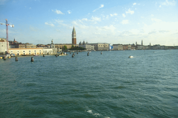
All over the world in different countries, cultures, tongues, and colors are people who have the same basic desire for happiness and respect from his fellow men. We are the same all over as members of the human race. If we honor each other's boundaries with propriety and consideration our voyage thru life can be rich in knowledge and friendship..........AMOR PATRIAE
|


Popular Posts
|


No comments:
Post a Comment